Lani Advokat

Condor Trail

400 miles across the length of Los Padres National Forest.

 
Screenshot 2025-04-14 at 10.09.22 AM.png
OVERVIEW


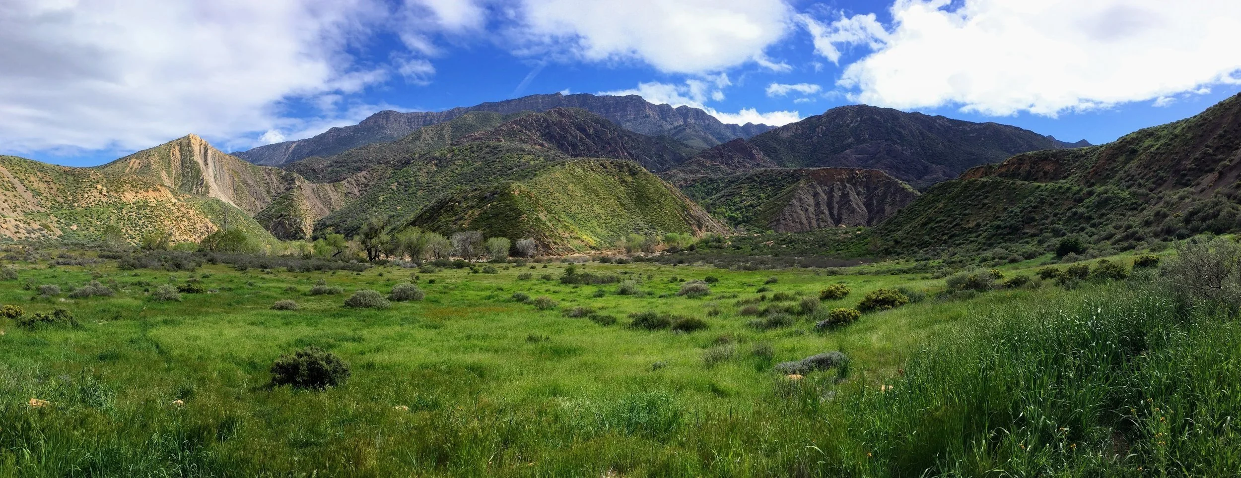
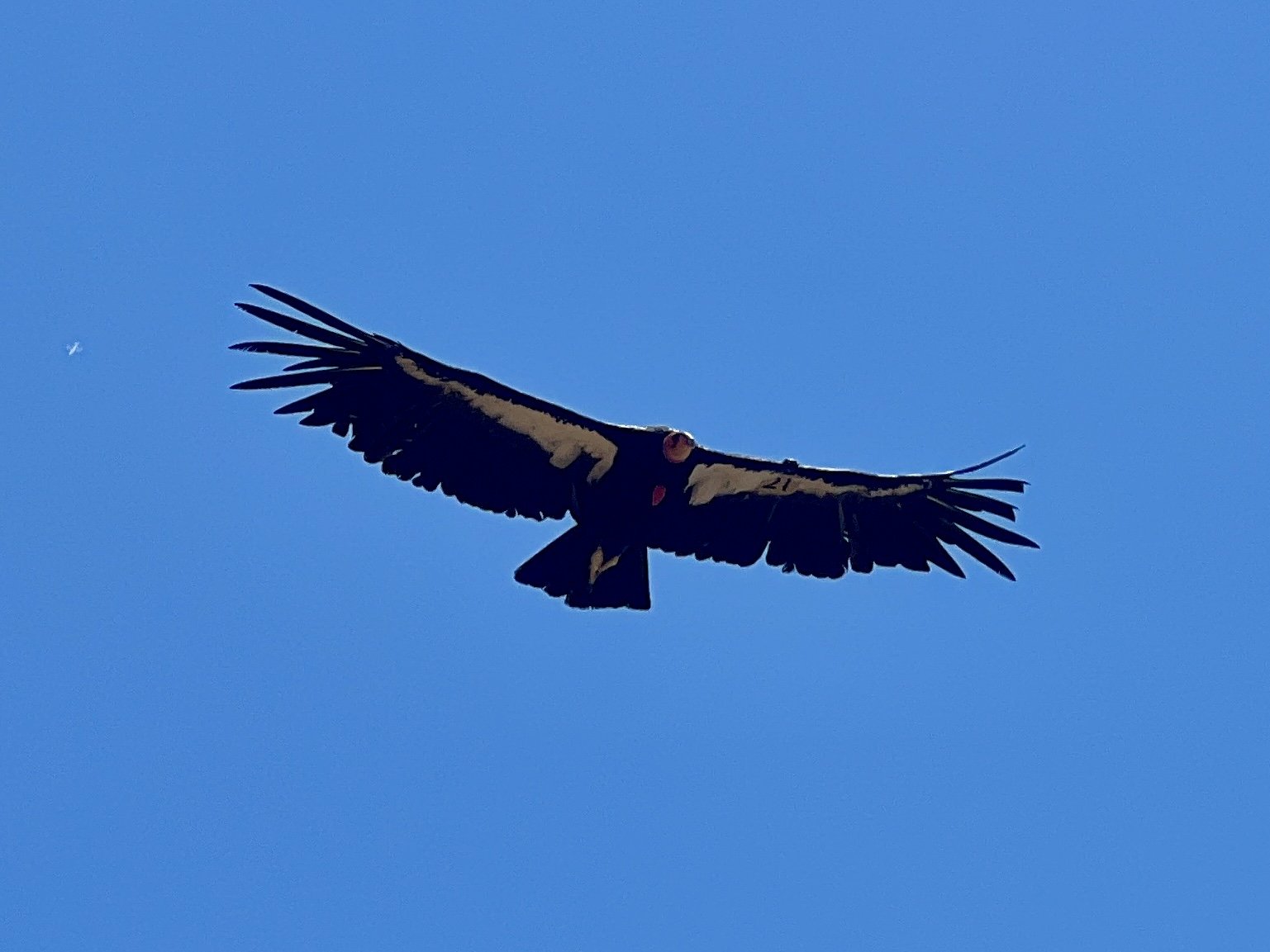
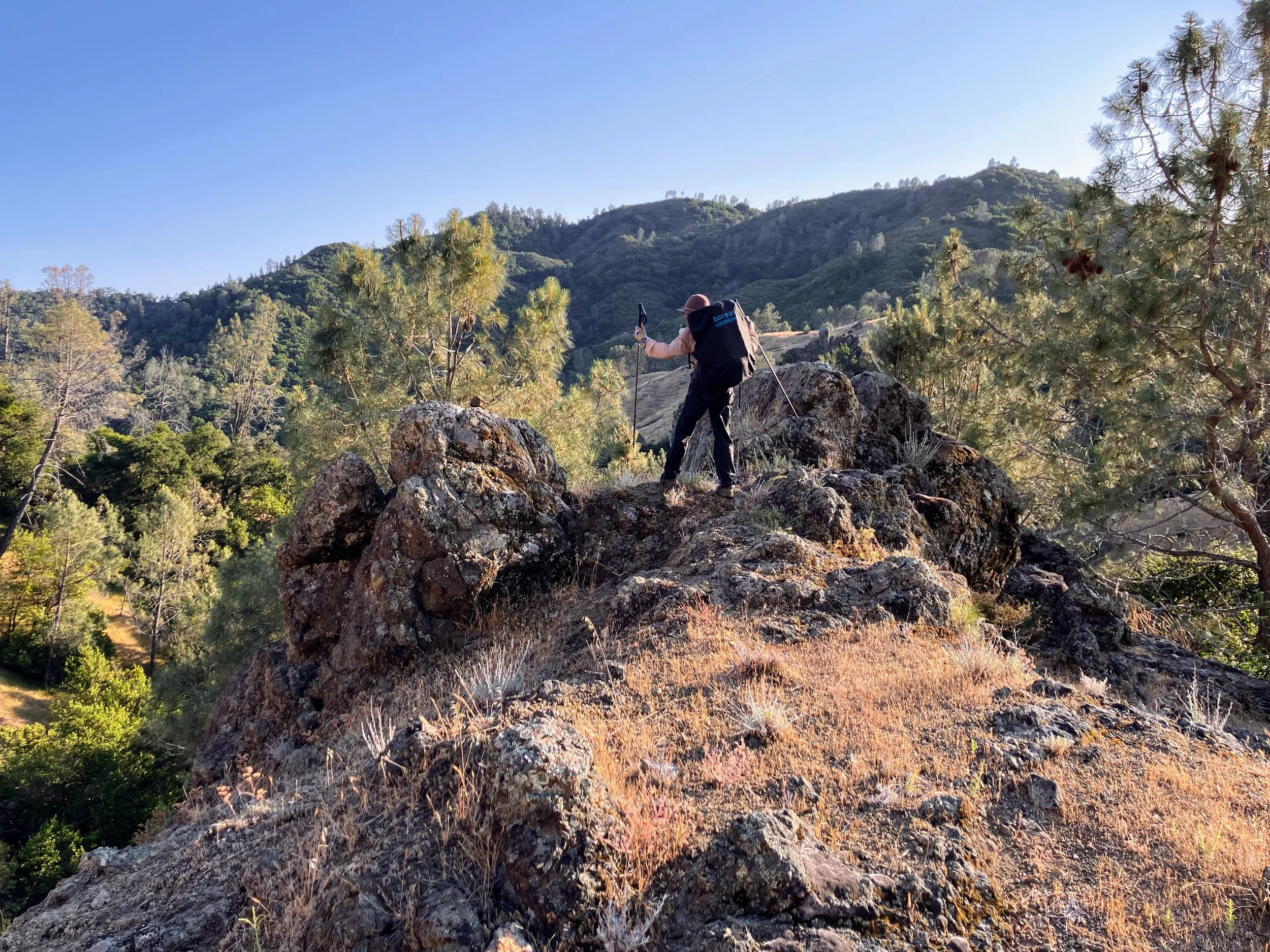
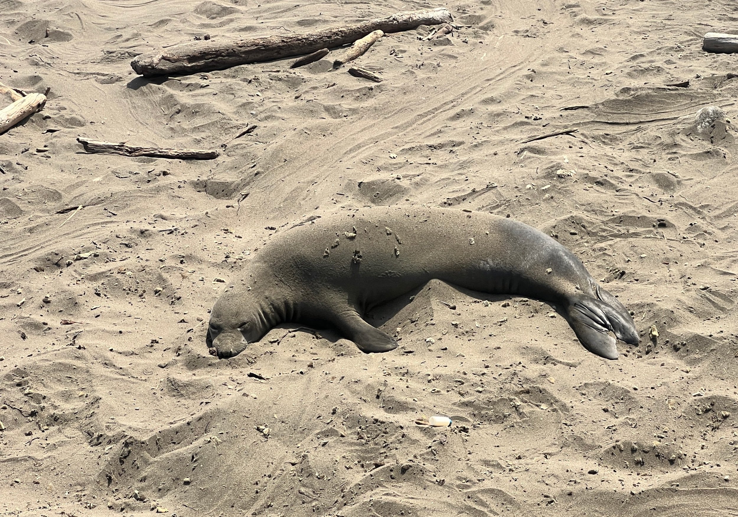
The Condor Trail is a 400-mile thru-hiking route that connects the northern and southern parts of Los Padres National Forest. Starting at Lake Piru on the border of Los Angeles and Ventura Counties, it stretches north to Botchers Gap just south of Monterey. Designed to highlight the unique beauty of Los Padres National Forest and the Central Coast of California, the trail winds through rugged backcountry areas in Ventura, Santa Barbara, San Luis Obispo, and Monterey Counties. Rather than being one continuous path, the Condor Trail is a network of smaller, existing trails linked together to form a thru-hike. It’s a lesser-known route, with very few people completing the entire trail.

For more details and trip planning resources, visit the Condor Trail website. I also highly recommend picking up the guidebook by Brian Sarvis and Bryan Conant.

PLAN

IMG_3820.jpeg
Hiking the Condor Trail is a great adventure. It allows you to be an explorer in wilderness sanctuaries and to experience a unique trail like no other.
— Bryan Sarvis

Tackling a route instead of an established trail can be intimidating and requires extra preparation. Much of my planning was based on advice from Brian Sarvis himself and the information found in his guidebook.


FUN FACTS AND STATS

Distance: Approximately 400 miles.
High Point: Topping out in the rugged mountains.
Low Point: The valleys of Central California.
Hiking Seasons: Spring and Fall
Number of Trail Towns: Multiple points to explore.
Terrain: Mix of established trails and rugged wilderness.
Challenging Sections: Steep climbs, dense brush, and occasional route-finding.


Getting Started

BEFORE YOU BEGIN

Planning for the Condor Trail, like any long-distance hike, required a lot of research. The best place to start was the guidebook by Brian Sarvis and Bryan Conant, which has been essential for understanding the route, as well as for planning food and water logistics.

Step 1. Research and Reach Out

We reached out to Brian Sarvis early in the process, and he went through our GPX track point by point noting important information and answering all of our questions.

Step 2. Organize Beta and Create Spreadsheet

We broke the trail into manageable sections and started planning resupply points. Using a spreadsheet, we tracked our mileage, estimated daily distances, and came up with a resupply plan that would include maildrops, town stops, and a few caches.

Step 3. Prepare and Ship Resupply Boxes

The most time consuming part of any thru-hike for me is putting together my food. My food boxes usually consist of a combination of homemade dehydrated meals, Heather's Choice vegan dinners, dried fruits, nuts, salty snacks, sweet snacks, and lots of C.S. Coffee!

Enjoying C.S. Instant Coffee after a trip in Death Valley National Park

Dinner on the Sierra High Route, 2024


Resupply Plan

Below you will find a basic outline of our resupply sections. The plan offers flexibility, serving as an estimate of days and miles while accounting for sections with big water carries, time needed for resupply pickups, and the possibility of tackling some Sierra Club Hundred Peak List peaks along the way.

Total Sections: 5 Estimated Days To Complete Trek: 21


1. Lake Piru (Start) to Dry Creek Road
86.1 mi // 4.5 days

2. Dry Creek Road to Adobe Trailhead
90 mi // 5 days

3. *Adobe Trailhead to Ragged Point Inn
118 mi // 5.5 days

*We will have the option to resupply in Morro Bay if we need more food.

4. Ragged Point Inn to Nacimiento Road
44 mi // 2 days

5. Nacimiento Road to Bottcher's Gap
63 mi // 3.5 days

CONDOR TRAIL JOURNAL

Stories for every day on trail

IMG_4161.jpg

Dates: May 14, 2025 - TBD  Days: TBD Miles: 400 (ish)


Can't find what you're looking for? Try searching below!


GEAR


IMG_1344.JPG
 
Out of clutter, find simplicity. From discord, find harmony.
In the middle of difficulty lies opportunity
— Albert Einstein


THE BIG STUFF


CLOTHES

WORN
Hiking Shirt:
Columbia Hiking Shirt w/ SPF (thrift store find)
Shorts: Everlast Black Shorts (thrift store find)
Sports Bra: Lulu Lemon
Hat: Stetson Explorer
Socks: Darn Tough
Shoes: Altra Superior
Fanny Pack: Atom Packs - The Roo
Trekking Poles: Black Diamond Distance Carbon FLZ Trekking Poles
Sun Gloves: Outdoor Research
Watch: Coros

CARRIED
Wind Jacket: Patagonia | Houdini
Puffy: Patagonia | NanoPuff
Rain Jacket: Arc'teryx | Alpha SL
Rain Pants: Sierra Designs
Gloves: Seirus | SoundTouch
Bug Net: Sea to Summit


COOKING + HYDRATION

COOKING
Cooking Pot: TOAKS Titanium 900ml D115mm Pot
Stove:
Snow Peak LiteMax
Spoon: TOAKS Long Spoon

WATER TREATMENT
Water Treatment: Aquamira
Water Filter:
Katadyn BeFree

FIRST AID + TOILETRIES

FIRST AID
Ibuprofen: Pain & altitude symptoms
Antihistamine: Allergies
Reusable Pads: Menstruation and/or gauze
Bandaids:
Various Sizes
KN95 Mask: Useful in case of wildfire smoke

TOILETRIES
Toothbrush + Toothpaste
Floss:
(can be used as thread for a sewing kit)
Antibacterial Wipes + Hand Sanitizer
Contact Solution + Contact Case
Glasses

REPAIR + ELECTRONICS

REPAIR
Sewing Kit:
Needle and thread.
Repair Kit:
Tenacious Tape
Knife: Spyderco Honeybee

ELECTRONICS
Phone + Camera: Iphone 13
Power Bank:
Anker 10,000 mAh
Tripod:
Pedco UltraPod
Charger Cable + Wall Port:
Anker 323 Charger Series 3 2-port USB-C + USB
GPS:
Garmin InReach Mini
Headlamp: Nitecore


FOOD

When preparing my resupply boxes, I focus on gathering lightweight, high-calorie, vegan-friendly food. I include a mix of nuts, dried fruits, salty and sweet snacks, as well as hearty plant-based dinners.


Questions about gear?